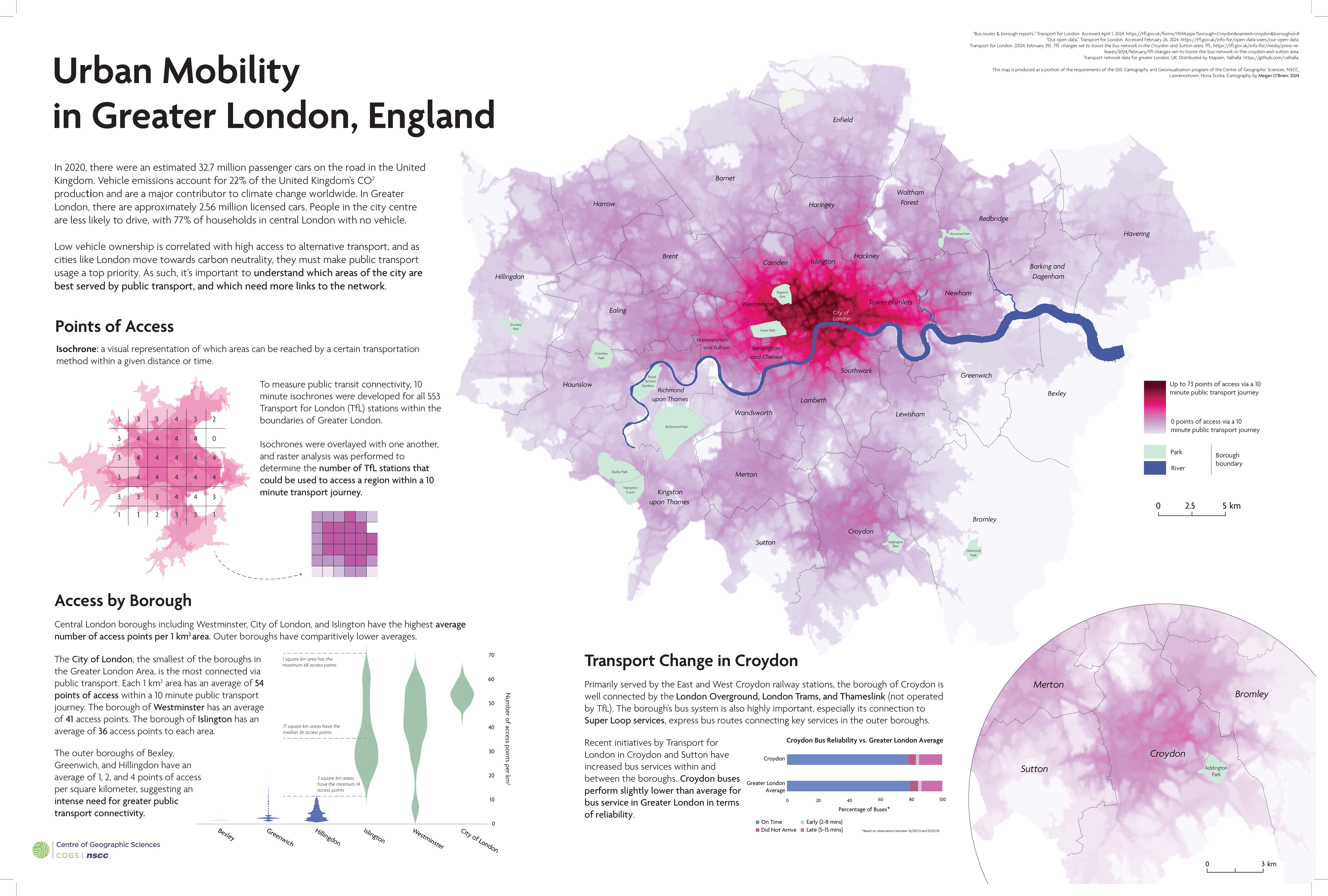
The goal of this project was to visualize the areas in Greater London that are most accessible via public transport. The final raster graphic was produced by overlapping 10-minute transit isochrones for each Transport for London (TfL) station located in Greater London.
This project was awarded the Canadian Cartographic Association (CCA) President’s Prize (College/CEGEP Category) and received an Honourable Mention for the Arthur Robinson Award (CaGIS).
This map will be on display at the Toronto Map Industry Summit (August 22, 2024) and the Calgary GoGeomatics Expo (October 28-30, 2024).

Leave a comment