Explore my portfolio of work by clicking on any of the thumbnails below. If you’d like to learn more projects using specific software including Adobe Creative Suite, ArcGIS Pro, or QGIS, or if you’d like to see examples of data processing with LiDAR, explore via the links below. Alternatively, explore by category.
Skills
- Adobe Creative Suite (9)
- ArcGIS Online (2)
- ArcGIS Pro (14)
- Blender (3)
- JavaScript (1)
- LiDAR (4)
- Mapbox (1)
- Python (4)
- QGIS (1)
- R (2)
- Tableau (1)
Categories

PEI Landscape Connectivity
As part of my work at the Wicked Problems Lab at Saint Mary’s University, we completed a landsape connectivity assessment for the Prince Edward Island…
Keep reading
Conferences – CAG, ACAG
From May 20th – 23rd, I had the pleasure of attenting the 75th Canadian Association of Geographers Annual General Meeting & Conference at Carleton University…
Keep reading
Nova Scotia Road Index
In a practicum term for the Nova Scotia Department of Natural Resources, I worked on developing a new Road Index tool to assess the ecological…
Keep reading
3D Cityscape Modelling
Using LiDAR data from swisstopo, I created a 3D model of the old town in Zurich, Switzerland.
Keep reading
Maritime Bathymetry
This project combined renderings of Maritime terrain in Blender with bathymetry vectors.
Keep reading
Urban Mobility in Greater London, England
The goal of this project was to visualize the areas in Greater London that are most accessible via public transport. The final raster graphic was…
Keep reading
Multi-Scale Mapping
Using knowledge of knowledge on colour, visual variables, levels of data measurement, symbolization, scale, and typography, a multi-scale mapping taxonomy chart for a topographic base…
Keep reading
Violent Crime Analysis in Surrey, England
Focusing on analyzing violent crime data in Surrey, UK, this project utilized a variety of geovisualization techniques in QGIS to identify regions with high incidences…
Keep reading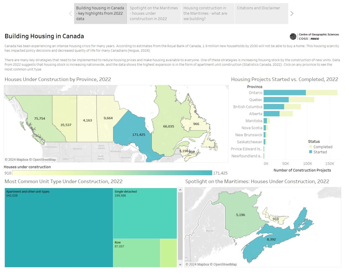
Tableau Interactive Maps
Building competencies in Tableau Desktop and exploring data about the Canadian housing crisis, this set of interactive maps and data visualizations provide some insight into…
Keep reading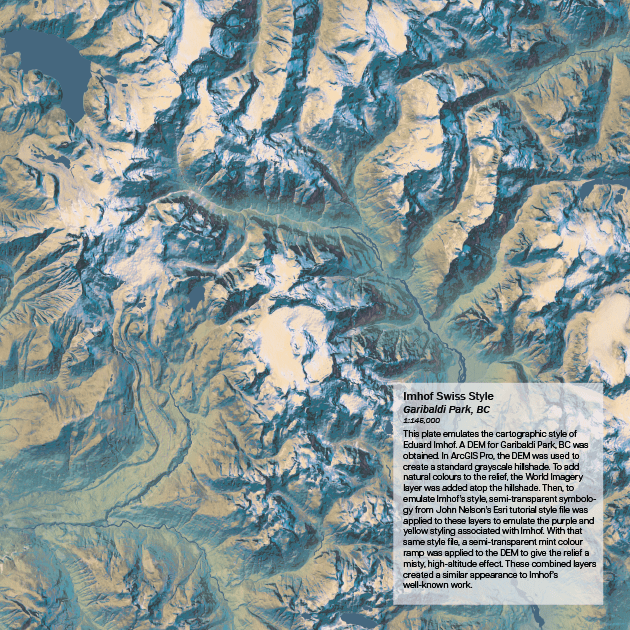
Terrain Atlas
The terrain atlas represents a culmination of skills in terms of working with terrain data, producing varying representations of terrain around the world. Techniques used…
Keep reading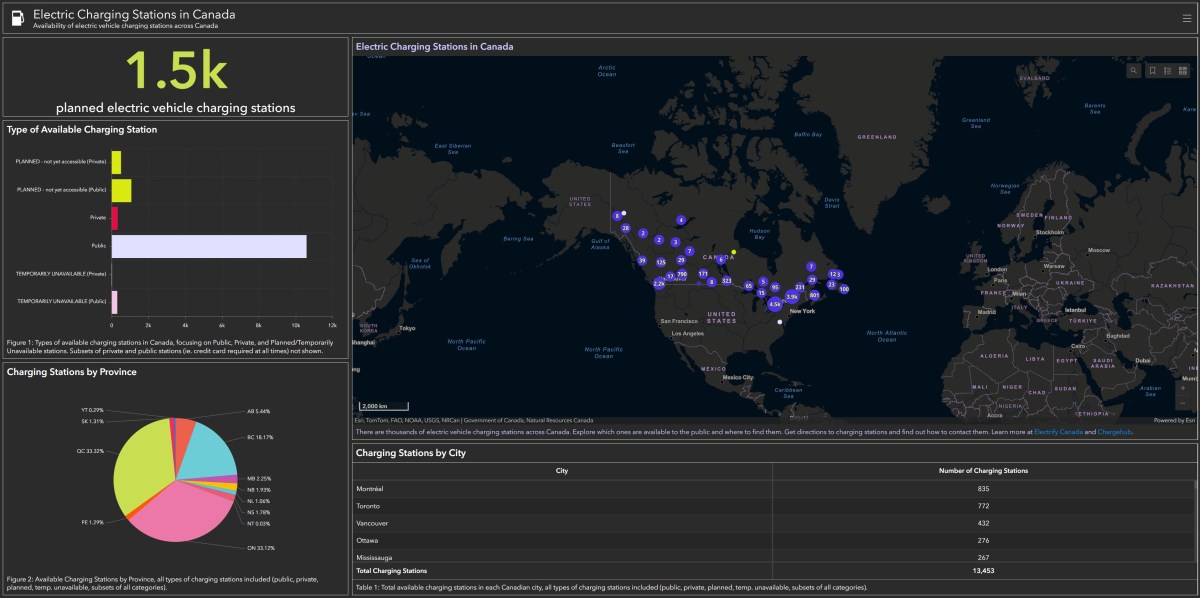
Electric Charging Stations in Canada
Using ArcGIS Online Dashboards, I synthesized information from National Resources Canada to visualize where drivers can locate electric vehicle charging stations across the country.
Keep reading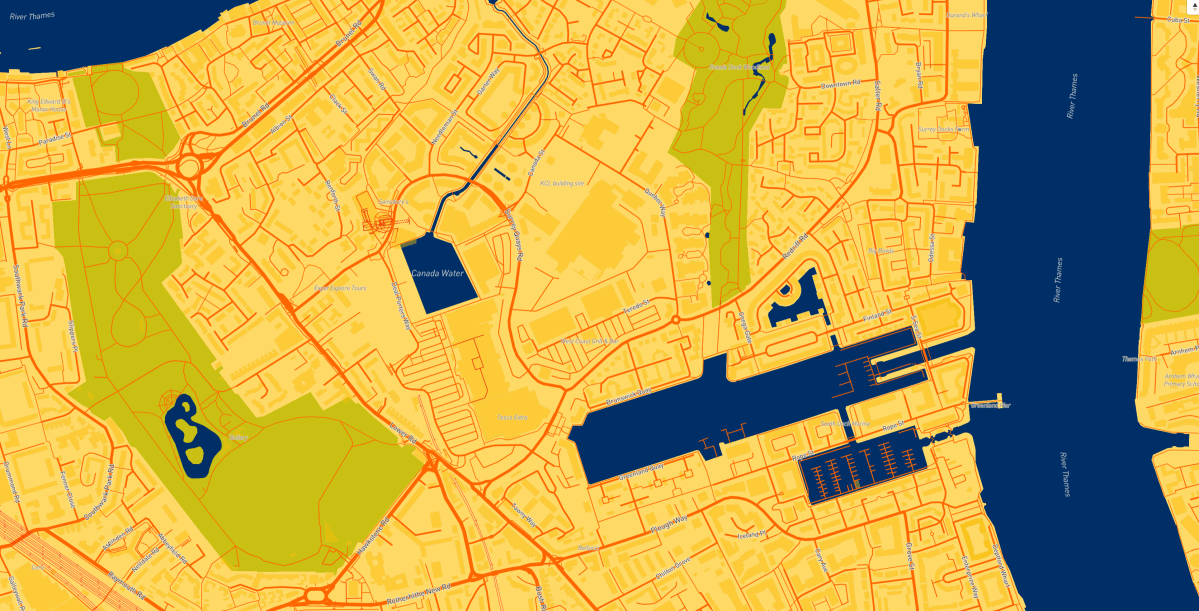
Cycle Parking in London, England
Integrating JavaScript libraries and Mapbox’s design technologies to dynamically visualize available bicycle parking in London, England.
Keep reading
Urban Mobility
ArcGIS StoryMap exploring best-in-class urban mobility around the world. Design samples below.
Keep reading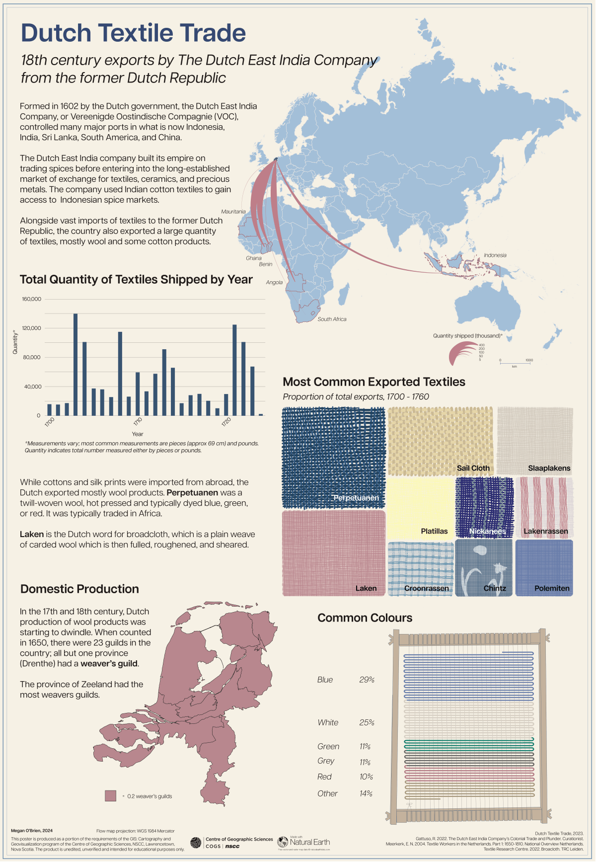
Statistical Infographic of the Dutch Textile Trade
This infographic explores different aspects of earth 17th century textile trades by the Dutch East India company. Combining techniques in ArcGIS Pro and design in…
Keep reading
Rocky Mountain National Park Reference Atlas
This is a reference atlas of Rocky Mountain National Park in Colorado, USA. The atlas focuses on the geological features of the park as well…
Keep readingSomething went wrong. Please refresh the page and/or try again.
