As part of my work at the Wicked Problems Lab at Saint Mary’s University, we completed a landsape connectivity assessment for the Prince Edward Island Forests, Fish, and Wildlife Division.
As part of this project, I used R to apply the Protected Network (ProNet) and Protected Connected (ProtConn) metrics to assess overall landscape connectivity for the protected areas network in Prince Edward Island. Then, I assessed movement through these protected areas by applying Circuitscape tools, which are coded in Julia. Cartography was performed in ArcGIS Pro. This assessment was used to make recommendations to the division regarding which protected area metric would be most effective for assessing connectivity.
Below is a summary of our work and our findings. The full paper is available to read here.
- An updated Road Effect Zone (REZ) was calculated using 2024 road data, which indicated that a higher proportion of the land area on Prince Edward Island is within a shorter distance to the road compared to 2019.
- The Protected Network (ProNet) and Protected Connected (ProtConn) metrics were calculated provincially and regionally for Prince Edward Island to compare the effectiveness of the metrics for assessing landscape connectivity.
- Landscape connectivity in the western region of the province is lower than in the eastern region.
- Highways bisect the province into regions which may limit provincial connectivity. Connectivity of regions divided by highways was compared using both metrics. The Summerside-Borden Carlton and Kensington-Morell regions consistently demonstrated low connectivity.
- ProtConn is recommended for assessing landscape connectivity due to its larger suite of indicators and more realistic approach.
- An updated Circuitscape current map was generated using Corporate Land Use Inventory data from 2020; resulting maps indicate that the decrease in natural and forested land from 2010 to 2020 has increased the intensity of several pinch points, while sometimes reducing the pressure in other areas.
Below are some examples of the analytical and cartographic work that I performed for this project.
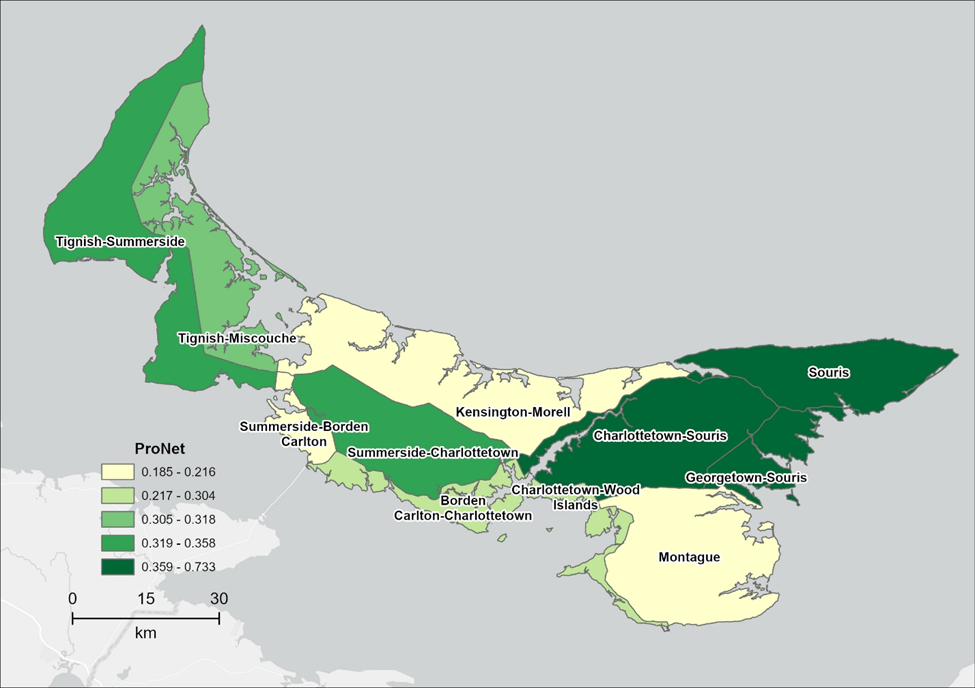
ProNet values for highway-based regions in Prince Edward Island.

Circuitscape assessment for natural ecosystems in Prince Edward Island.

Leave a comment