In a practicum term for the Nova Scotia Department of Natural Resources, I worked on developing a new Road Index tool to assess the ecological impact of the province’s transportation network on the surrounding landscape. The index calculations consider the type of transportation (e.g., highway, powerline, trail), the density of linear features, and the distance of an area from nearby transportation features.
The tool is built using Python code that utilizes the Nova Scotia Road Network (NSRN) to generate a complete Road Index raster. In this update, the code was modernized and streamlined to incorporate updated geoprocessing features, while also integrating recommendations from previous assessments of the Road Index since initial development.
This code is available on GitHub.
The Road Index code is versatile and can be used to visualize the ecological impact of roads as a numerical value, or in terms of “road influence”, where the index value is scaled to 0-100, and categorized as very low, low, medium, high, and very high road influence.
The Road Index tool is in the process of publication as a Technical Report by the Nova Scotia Department of Natural Resources. When it is published, it will be made available here.
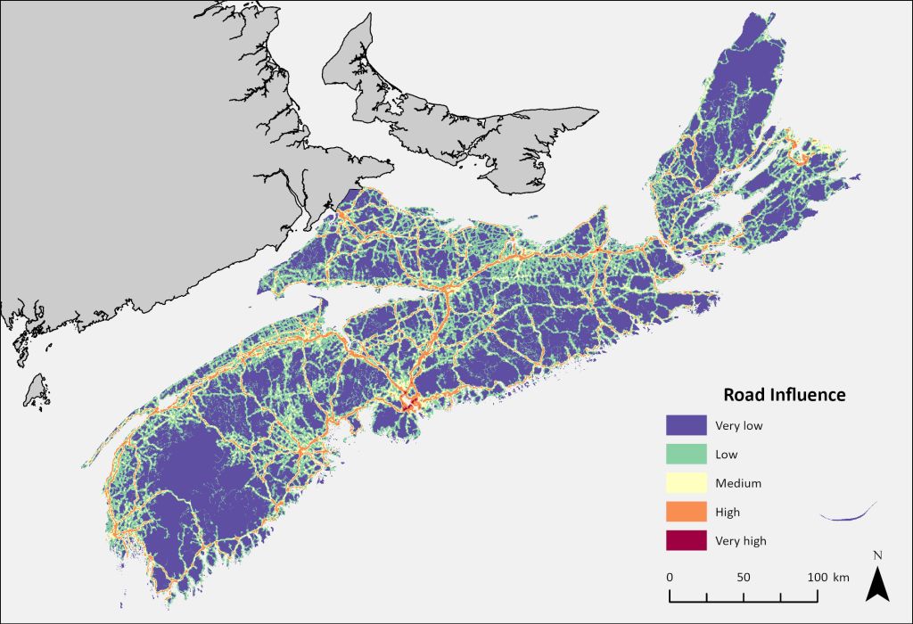
The influence of varying types of roads on Nova Scotia’s landscape. A majority of the landscape has “low” or “very low” influence, though higher road influence is concentrated in urban areas like Halifax, Truro, and Sydney.
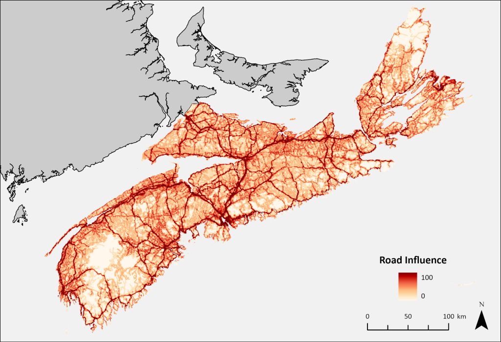
The road index can also be normalized to a score between 0 and 100.

Leave a comment