
Data acquired from USGS and Grand Banks Scour Catalogue (GBSC) GeoDatabase.
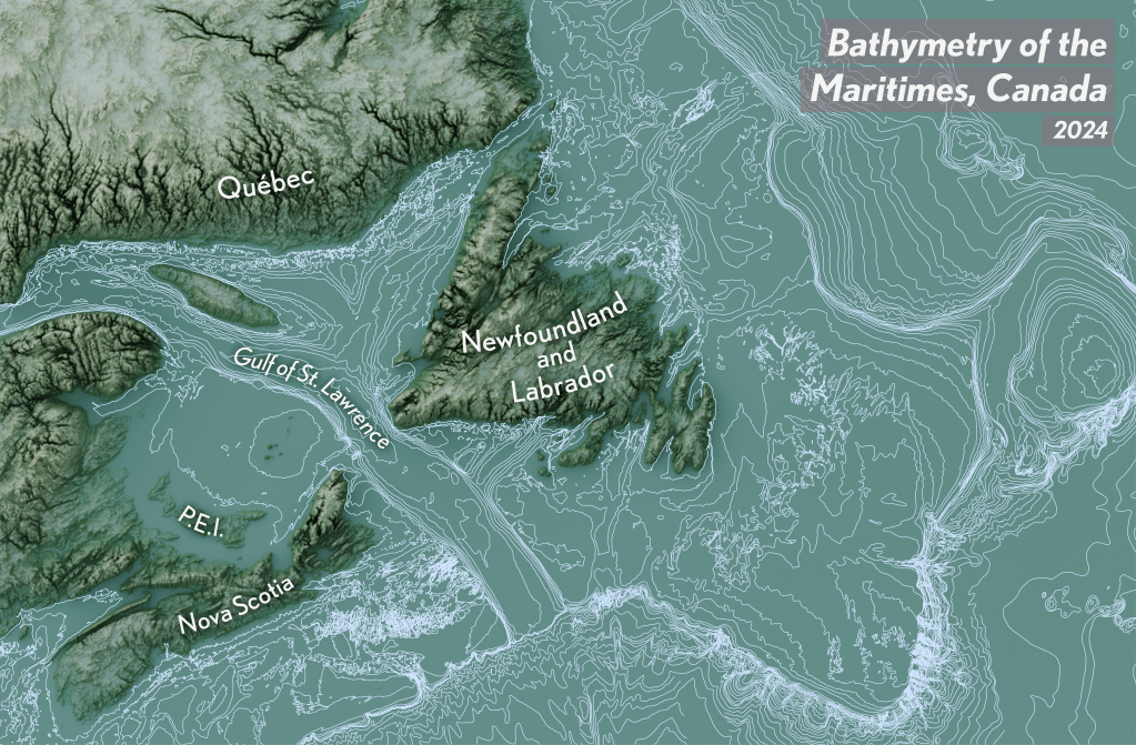
This project combined renderings of Maritime terrain in Blender with bathymetry vectors, which were prepared in ArcGIS Pro.
Written by
Data acquired from USGS and Grand Banks Scour Catalogue (GBSC) GeoDatabase.
This project combined renderings of Maritime terrain in Blender with bathymetry vectors, which were prepared in ArcGIS Pro.

Leave a comment