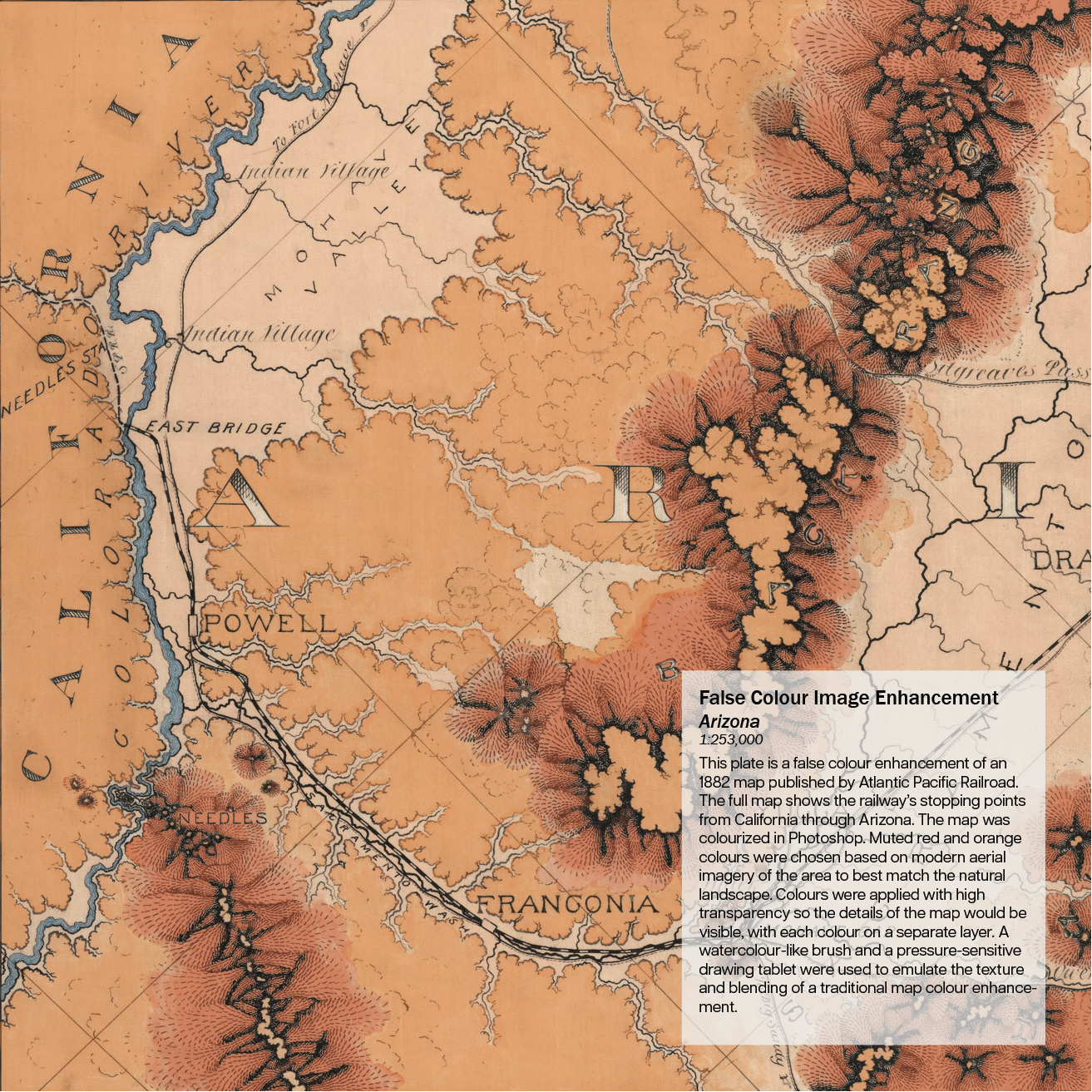
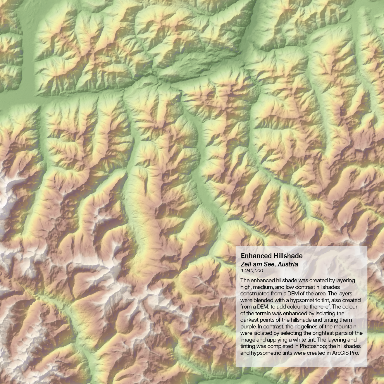
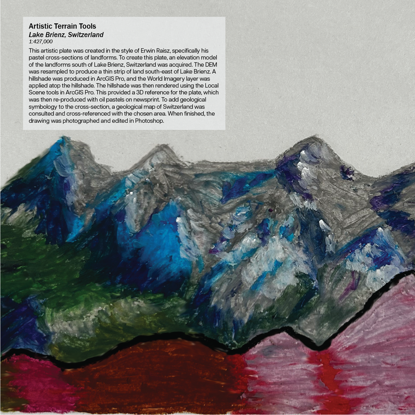
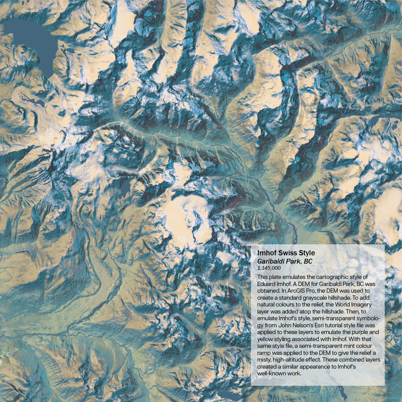
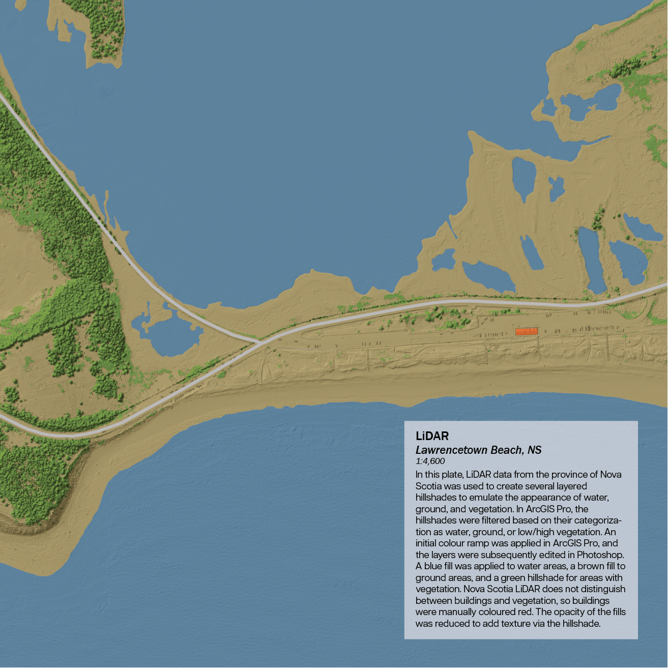
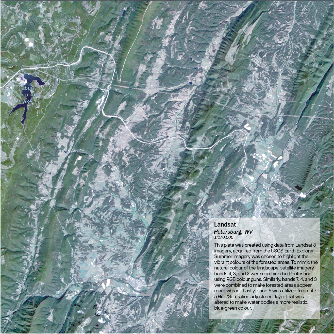
The terrain atlas represents a culmination of skills in terms of working with terrain data, producing varying representations of terrain around the world. Plates were produced in ArcGIS Pro, Photoshop, Illustrator, Blender, and by hand, using Landsat imagery, LiDAR data, and aerial photography.


Leave a comment